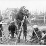
A surveyor friend of mine stopped by on the weekend. Actually, Reid Wilson asked if he could poke around the corner of my front yard last Saturday. I obliged, but wondered what it was all about. He said he was doing a quick unofficial survey looking for property lines, but he needed to find a key marker.
“Any idea where the corner survey stake is?” he asked me.
I told him he was in the right vicinity, but in the 25 years we’d lived on the property I’d never actually located that corner survey stake. I told him I had the actual survey document that dated back to the 1980s. But that didn’t get Reid any closer to finding the marker he was searching for.
“I’ll come back later with a detector,” he said.
That got me wondering about the traditional tools of surveying. I remember once researching the Dominion Land Survey. It was the organization of professional surveyors that essentially mapped out the lands that Canada would eventually annex as the Confederation of 1867 grew westward. These pioneer surveyors literally traipsed across 800,000 square kilometres of what is now Manitoba, Saskatchewan and Alberta, so that pioneers could eventually lay track for railways, break sod for farming and build centres of population.
Almost all of the surveying was based on the placement of survey markers, little more than iron bars (48 inches long and 5/8 inch in diameter) pounded into the ground at designated intervals – a primitive tool, but long-lasting, if unfortunately undetectable when Reid and I went looking for one on my front lawn.
By coincidence, also on the weekend, my neighbour and I cut down a couple of poplar trees in my backyard. I should say Nathaniel Lee, an arborist, did the professional work. I just assisted. Watching him work 30 and 40 feet above the ground made me appreciate the nature of his profession. Unlike some of the more mechanized tree-cutting operations that employ motorized cherry-picker units with a bucket, he simply strapped on a set of lower-leg supports and spiked boots and then used a series of ropes, pulleys, snaps and rings to shinny up the tree and bring it down limb by limb.
I asked him about the skills he required to do his type of work. Naturally, he said being fit was important. But it was clear, in addition, his work required the tools – the saws, the protective gear and all the specialized rigging – to bring these sizable trees down safely and efficiently. But I was particularly intrigued by his roping system. It was uncomplicated, didn’t rely on machinery and allowed him to both manipulate himself and the pieces of the tree with surgeon-like precision. The only heavy-duty machine he used that day was a motorized chipper that chopped up the brush into compost.
“I love this kind of work,” he told me, “except in the dead of winter.”
My mind flashed back to yet another traditional work situation. Not long after we moved into the community – back in the 1980s – I remember travelling along a regional road, west of my hometown north of Toronto. The region was replacing its weathered old telephone poles. I might have passed all that roadside work without stopping, until I spotted a man guiding a horse through the roadside grass. The horse was hauling the new telephone poles into position. I had to ask. With all the sophistication and speed of heavy-duty equipment, why would the crew use a horse and driver?
“The horse can negotiate through trees and ditches where a tractor or dozer can’t,” the driver said. “Simple as that.”
Yes, I guess it really was another case of keeping it simple.

By the way, my surveyor friend, Reid Wilson, eventually returned to search out that iron survey peg in my front yard. But he arrived not with the metal detector he wanted. Instead, he’d returned with a compass.
“A compass?” I asked. “How’s that going to help?”
Well, with a smile on his face, Reid leaned down to show me. In a series of sweeps – just a few inches off the ground – he began passing the compass over the grass in the corner of my front yard. Suddenly, the compass needle began gravitating to a spot in the centre of his sweep. Reid took his shovel and on the spot drawing the compass needle, he dug down through the sod three or four inches, and sure enough, there was the top of the iron survey peg.
I suppose Reid could have used the more sophisticated Global Positioning System (GPS) to locate the exact survey spot for which he was searching. And Nathaniel could have used a cherry-picker with a bucket to bring down those trees. The modern tools would have completed the job faster and more economically.
But then, maybe there’s more to getting things done than speed and economy.